There are literally dozens of awesome hiking trails in and around the Palm Springs area and we wanted to share just a few that have really great views.
Coachella Valley is surrounded by four mountain ranges- San Bernardino, Santa Rosa, San Jacinto, and Little San Bernardino. Palm Springs is in the Sonoran Desert, and close to San Bernardino National Forest, Santa Rosa, and San Jacinto Mountains National Park. Therefore, all of these surroundings offer great terrain and many options (more than 1,000 miles!) for hiking trails.
There’s so much beauty in the desert landscape of the Palm Springs area, plus over 300 days of sunshine every year! Palm Springs hiking will provide scenic vistas and potential wildlife sightings. But be aware, daytime high temperatures in the Valley can be in the triple digits between June and October. Therefore during these months, you’ll want to start as early as possible in the morning.
Hiking Safety in the Desert Tips
- WATER. Plan for ½ liter per hour of hiking and turn around when half of your water is gone. Drinking when you feel thirsty is too late.
- MAP. You may not have cell service throughout an entire hike, plan ahead and download trail maps to your device.
- SUN PROTECTION. Whatever this means for you- sunscreen, sun hat, long sleeves, light pants, as much sun protection as possible.
- FIRST AID. Pack the basics- antiseptic wipes, antibacterial ointment, bandaids, sting spray, Benadryl, ibuprofen, and tweezers or a comb to remove cactus spines
- EARLY START. Be sure to beat the heat by starting before 9am in the Summer & Fall.
- STICK TO THE TRAIL. This will prevent you from getting lost (solving for #2) and reduces risk of cactus spines (solving for #4).
Recommended Beginner & Moderate Hikes
Hiking in Palm Springs Area
- Palm Canyon Trail
Difficulty: Easy
Miles: 2.0
Elevation Gain: 295’
Type: Out & Back
Traffic: Heavy
Best Months: November to July
Notes: There can be a line to get into the park on weekends, another reason to arrive early. There is a $9 entrance fee to get onto the reservation (for adults). The park closes at 5 pm, so plan accordingly, to not get towed.
Location: The turn-off to the Palm Canyon Trailhead is located 18 miles south/west of Highway 111 or 6 miles east of the Hwy 371 intersection on Hwy 74. Turn north on Pine View Drive. Do not turn north on Palm Canyon Drive, as this will not lead you to this trailhead.
- Palm Canyon Trail to Vandeventer Trail (extension of #1 trail above)
Difficulty: Moderate
Miles: 4.8
Elevation Gain: 807’
Type: Out & Back
Traffic: Light
Best Months: October to May
Notes: same as above
Highlights: Views!
Location: same as above
- Desert View Trail
Difficulty: Easy
Miles: 1.5
Elevation Gain: 311’
Type: Loop
Traffic: Heavy
Best Months: April to October
Highlights: The world’s largest rotating tram car carries you to your trailhead in the Mt San Jacinto State Park wilderness, providing breathtaking views on the ride up as well as the hike down.
Location: 1 Tram Way, Palm Springs, CA 92262
To access the trailhead, ride the Palm Springs Aerial Tramway to the Mountain Station at 8,516’ elevation for access to over 50 miles of hiking trails. Tram cost is $25 per adult.
- Hidden Lake via Willow Creek Trail
Difficulty: Moderate
Miles: 5.0
Elevation Gain: 971’
Type: Loop
Traffic: Heavy
Best Months: April to October
Notes: Wilderness permits are required (free) and available at the Ranger Station at the first junction past the Tram station.
Highlights: This trail begins with a steady climb along a seasonal creek to Round Valley, then travels along the rim of the valley with views of Mt San Jacinto and other nearby peaks.
Location: 1 Tram Way, Palm Springs, CA 92262
To access the trailhead, ride the Palm Springs Aerial Tramway to the Mountain Station at 8,516’ elevation for access to over 50 miles of hiking trails. Tram cost is $25 per adult.
- Palm Springs Museum and North Lykken Trail
Difficulty: Moderate
Miles: 3.7
Elevation Gain: 1735’
Type: Out & Back
Traffic: Heavy
Best Months: October to March
Notes: Horses are allowed to use this trail
Highlights: Awesome views of Palm Springs!
Location: Palm Springs Art Museum- 101 N Museum Dr, Palm Springs, CA 92262
Parking is available at the museum or on the street in front of the museum
Hiking in La Quinta Area
- Morro Trail (AKA La Quinta Cove to Lake Cahuilla)
Difficulty: Moderate
Miles: 6.6
Elevation Gain: 915’
Type: Out & Back
Traffic: Heavy
Best Months: year-round
Notes: Trail surface is loose gravel, wear sturdy shoes. There is NO SHADE on this trail so plan accordingly. No dogs allowed.
Highlights: Bighorn sheep sightings, wildflowers, scenic views.
Location: The trail can be done in either direction by parking at Lake Cahuilla or La Quinta Cove. Or for a shorter option, vehicle access to Lake Cahuilla County Park allows for a one-way hike with a shuttle pick-up.
- La Quinta Cove
Difficulty: Easy
Miles: 3.6
Elevation Gain: 390’
Type: Out & Back
Traffic: Moderate
Best Months: year-round
Notes: This trail is also used for trail running and mountain biking
Highlights: Wildflowers
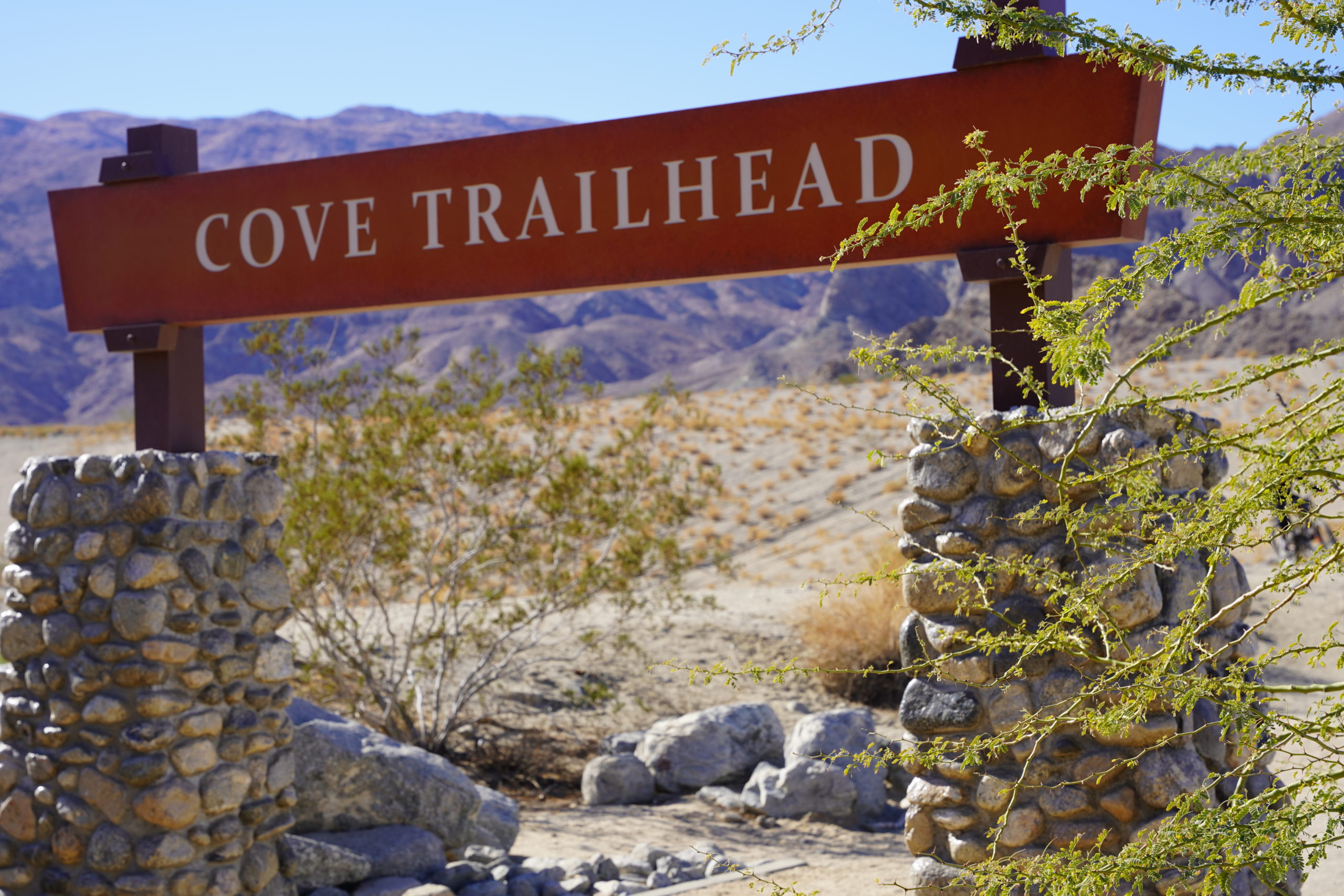
Location: Cove Oasis Trailhead- 54990 Avenida Madero, La Quinta, CA 92253
Fitness On the Go Made Easy
With an array of views and options like these, you have plenty of choices to get out and hike Palm Springs. Plan your route, gather your gear, and go enjoy all of the the beauty that Palm Springs has to offer. Get up, get out, and get moving!




0 Comments